
Records That Describe Bellingham Neighbors
No official Bellingham source names every person on a block. Instead, the county and city publish parcel, ownership, map, permit, election, and historical records with distinct dates and labels. Use this coverage table to choose a source, then report its relationship exactly.
| Source | What It Shows About a Block | Access |
|---|---|---|
| County Parcel Viewer and CityIQ | Adjacent parcels, situs, city limits, neighborhood, precinct, ward, and selected layers | Public web maps; recorded plats control legal boundaries |
| Whatcom Real Property Search | Owner, mailing address, parcel ID, legal description, sales and map links | Public portal; Assessor office, phone, and email are fallbacks |
| Washington voter extract | Dated registration address, precinct and district fields for active voter records | Request with use agreement and statutory limits |
| City neighborhood map and pages | One of 25 official planning-area names and civic context | Public city sources; not a household directory |
| BPL reverse directories | People listed by street address in an edition from 1931 onward | Library access; some tools require a card or in-library use |
The assessor proves who the roll names as owner, not who sleeps at the situs. A different mailing address can point to an owner who receives tax mail elsewhere. Likewise, a voter entry documents contact with the election system at a date, and a neighborhood contact represents a civic role. These distinctions keep a neighbor lookup useful without turning hints into unsupported claims.
Place Bellingham Neighbors in the Right Area
Bellingham recognizes 25 neighborhood names: Alabama Hill, Barkley, Birchwood, City Center, Columbia, Cordata, Cornwall Park, Edgemoor, Fairhaven, Happy Valley, Irongate, King Mountain, Lettered Streets, Meridian, Puget, Roosevelt, Samish, Sehome, Silver Beach, South, South Hill, Sunnyland, Western Washington University, Whatcom Falls, and York. These are city planning and GIS labels, not legal address fields or proof of membership in a group.
City limits have also changed through annexations. An address now on a Bellingham block may have been county territory at the date of an older record. A Bellingham postal label can also sit outside the municipal boundary. Record the map layer, retrieval date, and source date before assigning a neighborhood, ward, precinct, or city jurisdiction.
Walk Parcels Around Your Bellingham Neighbors
The Whatcom County Map Portal launches the Parcel Viewer and links tax maps, districts, hazards, watersheds, and other official map tools. CityIQ adds smart address or intersection search, city limits, neighborhoods, wards, precincts, historic streets, annexations, and parcel information. Use the map as a locator, then open the assessor record for each lot.
- Preserve the full address, postal city, ZIP, and date, then find it in CityIQ or the County Parcel Viewer.
- Select the subject parcel and note the parcel/Geo ID, situs, legal-location clues, neighborhood, and city-limit layer.
- Move clockwise through touching and facing parcels, recording each parcel ID before opening the assessor card.
- Transcribe the owner and mailing address as labeled. Do not convert either field into an occupant statement.
- For a full named street rather than the immediate block, use the broader street workflow.
The county warns that its viewer is not legal boundary evidence. Deeds, plats, surveys, and recorded easements control. If the task expands beyond facing and touching parcels, the Bellingham street directory explains the full street-by-street chain.
The county map source is shown below as the official starting point for adjacent-parcel research.
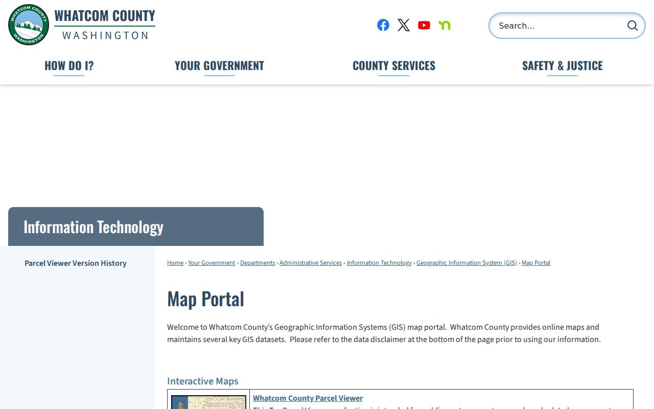
After finding the block here, move to the assessor card for ownership fields and to recorded documents for controlling legal detail.
Confirm Bellingham Neighbors by Parcel Role
The Whatcom County Real Property Search accepts owner, street number, street name, city, Property ID, parcel/Geo ID, subdivision, condo, township, range, and section fields. A parcel card can show situs, owner, mailing address, ownership percentage, abbreviated legal description, neighborhood and map IDs, tax area, land-use code, and property flags.
| Assessor field | Safe description | Needed cross-check |
|---|---|---|
| Owner | Owner-of-record for the displayed tax year | Recorded instrument for title history |
| Mailing address | Destination for assessor correspondence | Situs if studying the block |
| Situs/location | Mapped property location | CityIQ for city and neighborhood layers |
| Parcel/Geo ID | Join key for map and document searches | Legal description when parcel history changed |
The Assessor office is at 311 Grand Avenue, Suite 106, Bellingham, and lists 360-778-5050 and assessor@co.whatcom.wa.us. Those channels matter when a portal field is unclear or an older tax-year display is needed.
How Voter Data Relates to Bellingham Neighbors
VoteWA is a self-service lookup requiring matching first name, last name, and date of birth. It is not a public neighbor-search box. The separate Secretary of State voter database extract can include active voters, current and previous-year voting history, registration street components, unit, city, ZIP, precinct, districts, mailing fields, registration date, last voted date, and status code.
The request form records requester contact fields, the selected data file and county, and agreement to the published terms. Requests may take up to five business days. Current voter lists and poll books are public under RCW 29A.08.720, but RCW 29A.08.740 restricts use for advertisements, offers, or solicitations involving money, services, or value. RCW 42.56.070(8) also limits commercial lists. Washington does not register party preference, so never infer one from a record.
Note. A voter record is dated civic-registration evidence, not proof of continuous residence or every person in a nearby household.
Community Sources for Bellingham Neighbors
Public sources reviewed for this project did not expose household rosters for Bellingham's neighborhood associations. Use official neighborhood pages for planning boundaries, and use local research institutions for dated community context rather than asking volunteers to disclose private member details.
| Community source | Contact or access | Useful block context |
|---|---|---|
| Bellingham Public Library | 210 Central Avenue; Reference Desk 360-778-7323 | Reverse directories, yearbooks, Herald microfilm, Sanborn maps |
| Whatcom Museum Photo Archives | 201 Prospect Street; research room Wednesday-Friday, 1-5 p.m.; 360-778-8952 | Photos, city directories, maps, books, PastPerfect search |
| WWU Archives and Special Collections | Research application when an online description is insufficient | Regional manuscripts, oral histories, maps, newspapers, photographs |
| Northwest Regional Archives | 808 25th Street; confirm appointment and closure days | Historical Whatcom government records |
| Whatcom County Historical Society | PO Box 135, Bellingham WA 98227; whatcomhistory@gmail.com | Research lead, though item-level online holdings were not located |
These channels can explain how a block changed, who appeared in a dated directory, or how a civic group used a place. They should not be treated as present-day neighbor lists.
Official Rolls and Commercial Neighbor Tools
Official records are narrower but easier to cite. They identify the custodian, field label, date, jurisdiction, and correction route. Commercial neighbor tools may combine stale or mismatched material, hide source dates, or charge for results. They are leads only and should never override an assessor card, map layer, voter-use rule, or archive citation.
| Measure | Official source | Commercial category |
|---|---|---|
| Relationship shown | Specific role such as owner or registered voter | Often a combined, unclear association |
| Date and jurisdiction | Usually identifiable in the record | May be old or hidden |
| Correction | Custodian-specific request route | Separate publisher process |
| Best use | Citable parcel, civic, map, or archival fact | Starting lead that needs independent confirmation |
For a common name, require a second identifier such as a parcel ID, middle name, document date, or dated address. A claimed error should go to the source custodian as well as any publisher that repeated it.
Why Blocks Around Bellingham Neighbors Change
The present city grew from four bay settlements, and records may say Fairhaven, Sehome, Whatcom, New Whatcom, or Bellingham. Annexations also moved blocks into city jurisdiction over time. CityIQ's historic-town, historic-street, shoreline, annexation, donation-land-claim, and parcel-history layers can explain why an old directory or map seems to conflict with today's block.
For a deeper historical check, pair a 1904 Sanborn sheet with the 1905 Polk directory and a recorded instrument. The map describes the structure, the directory gives a dated listing, and the instrument records a legal transaction. None alone proves a modern household. This source stack preserves the distinction between community memory and current neighbors.
Protect Privacy When Researching Bellingham Neighbors
Washington public access does not override court restrictions, voter-use rules, vital-record limits, or the Address Confidentiality Program. ACP supplies a substitute address for qualifying survivors and other protected participants. Actual address and location fields are confidential under the program, and a substitute address is a safeguard rather than a data error. RCW 40.24 and WAC 434-840 govern its protections.
Minimize personal data. Keep the role, source, date, and jurisdiction, but omit full birth dates and other sensitive fields. Do not combine public records into a map that increases risk. If a person disputes a listing, identify the source and direct the correction to its custodian.
Lawful use. Research Bellingham neighbors for civic curiosity, community history, reconnecting, or personal safety awareness. Never use a block search to watch, threaten, harass, intimidate, or harm anyone.